
Cambridge Bay (CBB) Magnetic Observatory
| Name | Cambridge Bay |
|---|---|
| IAGA alphabetic code | CBB |
| IAGA numeric code | 021255 |
| Geographic coordinates | 69.123° N, 254.969° E |
| Geomagnetic coordinates (IGRF-12 (2015)) | 76.21° N, 53.68° W (2015.0) |
| Elevation | 20 m |
| First year | 1972 |
| Observatory data | link |
For more information about IAGA, please visit the IAGA web site.
Owing to the effects of the large induction anomaly at Alert, a decision was made to reduce the magnetic program at Alert in 1972. It was initially planned to replace Alert with an observatory at Eureka (80 deg. N. 85 deg. 56 min. W). However, an analysis of magnetic survey results from 1960 to 1962 showed that the effects of the Alert anomaly were significant at least as far south as Eureka. As the next stage in selection of a suitable site, a recording fluxgate magnetometer was operated at Cambridge Bay for two months in the summer of 1968. No unusual effects were observed in these recordings. In addition, Cambridge Bay is situated under the magnetospheric cleft region, and was expected to provide valuable data for magnetospheric studies.
A preliminary site selection was made from an air photo of the area in consultation with officers of the Department of Indian and Northern Affairs. Consequently, a 90,000 sq. m area, 180 m north of the coast and 15 km east of the village, was selected. The site is one of metamorphosed sedimentary rocks of Ordovician and Silurian age. A total force survey of the proposed site was made in September, 1971. Readings were taken at intervals of 30 m along two lines in the east-west and north-south directions. Gradients were 1.5 nT in 10 m to the north and 3 nT in 10 m to the south of the proposed building site. Soil borings taken earlier had confirmed that the site was suitable for a building as no permafrost had been found. The lack of permafrost is attributable to the location of the site which is on top of a 17 m gravel hill.
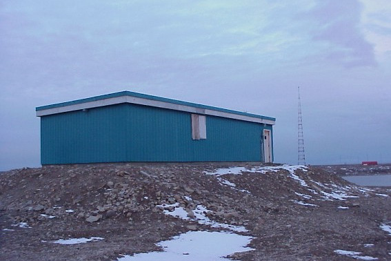
The building was completed in December, 1971. It is of the same construction as the ones in Resolute Bay, N. W. T. and Baker Lake, N.W.T.
Recordings of the geomagnetic field commenced with the installation of an AMOS Mk I in April, 1972. The aging AMOS MK I was replaced by the AMOS Mk III in March, 1982. In turn the AMOS Mk III was replaced by the INTERMAGNET compliant CANMOS in the first week of 1992.
CANMOS (Canadian Magnetic Observatory System) has been designed by the Geomagnetic Monitoring Service staff, who have developed the software to control the magnetometers and to process the basic digital data. CANMOS includes:
- a commercial tri-axial ringcore fluxgate magnetometer, mounted on a tilt-correcting suspension (of NRCan design)
- an Overhauser Proton Precession Magnetometer
- a bus-clock for timing control
- various storage media
- RS-232 outputs for 1 second, 5 second and 1 minute data streams
The AMOS MK I and III were instruments designed and manufactured by the then Dominion Observatory and Earth Physics Branch. These instruments differ significantly from a commercial version which was also named AMOS.